MIXED USE DEVELOPMENTS
U.S. VIRGIN ISLANDS
PROJECT STATUS | PARTIALLY COMPLETED
THE ISLANDS CONTEXT
The economic cost of abandoning infrastructure in the older towns and rebuilding farther out has been questioned by many urban design and planning movements, especially if new construction is proposed on virgin, greenfield land. In the Virgin Islands, we have advocated to prioritize redevelopment and infill projects in abandoned or dilapidated urban quarters that were once thriving neighborhoods.

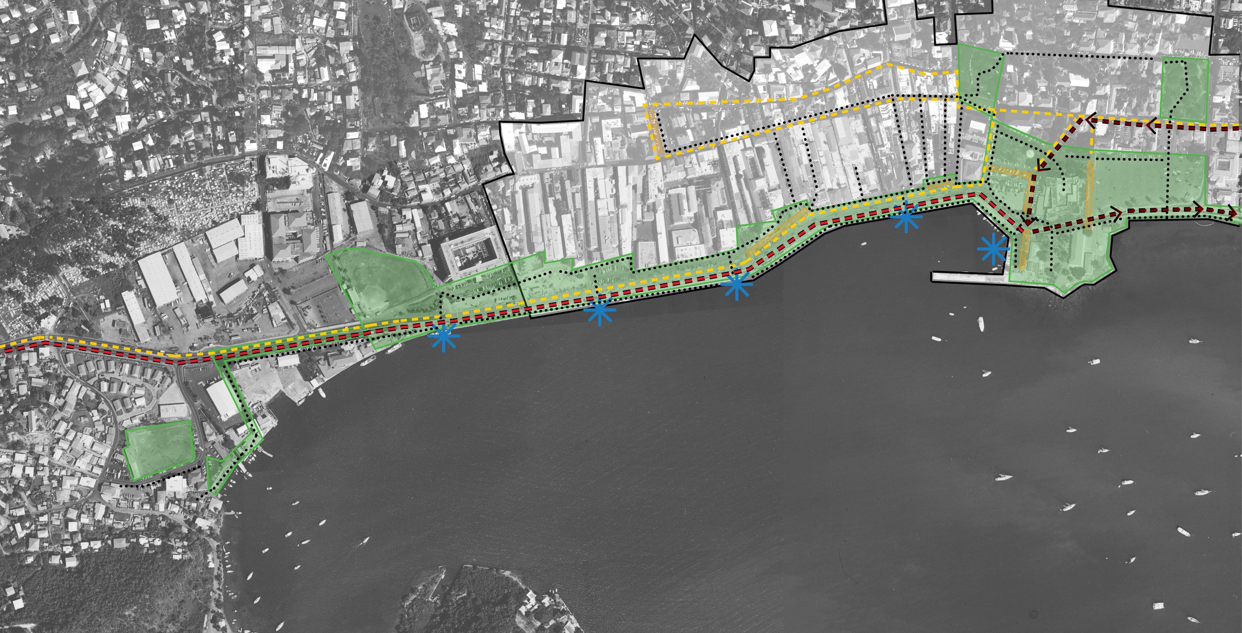


Focusing on mixed-use, open space, walkability, safety measures and other amenities, it is possible to restore the once viable communal life of our islands’ historic districts, creating new desirability to live downtown and thereby decreasing the current development pressure on the suburban fringes of the Territory. From our office in Charlotte Amalie, we embraced many small and large projects, backed by business owners and community groups, aimed at rehabilitating the town.
At the same time, we embarked on an ambitious mixed-use redevelopment project with a mega-yacht marina in Long Bay, at the other end of the harbor. We helped develop a vision for a pedestrian-friendly downtown district that would encompass the whole waterfront from the town of Charlotte Amalie to the cruise ship dock of Havensight, with multimodal transportation to decrease road traffic. The narrow courtyard morphology and small building scale of the historic district were used as inspiration for the Yacht Haven Redevelopment, with the goal of unifying the harbor morphology when arriving from the sea.
However, because new residents and homeowners want to live closer to our natural assets, we have also embraced projects that, though sited on previously undeveloped land, rigorously follow the parameters of mixed use—to avoid pressure on public infrastructure and services—or are based on low-impact development principles—to protect those very natural features that drive development there in the first place. We have also assisted in developing programs with sustainability and a larger socio-ecological context in mind, important to build consensus and to ensure the project’s viability.
SUGAR ESTATE, ST. THOMAS U.S. VIRGIN ISLANDS
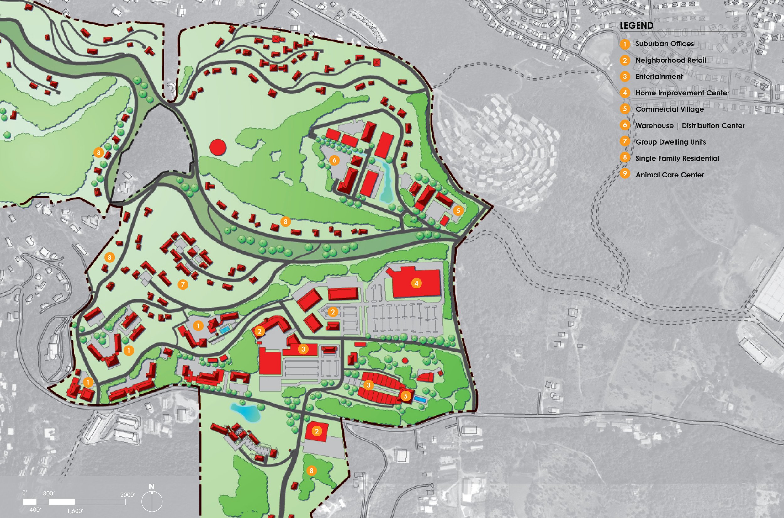
This was a concept master plan for the 500-acre commercial and residential property located on two large parcels of private land holdings in the central part of the island of St. Thomas. The owners believed that a secondary growth center could occur in the center of the island for institutional, commercial, and other services, relieving the cross-island traffic from the east to the southern coast of St. Thomas Island, where the capital, Charlotte Amalie, is situated. We feared, however, that this could further drive suburbanization and drain the institutional and governmental role that Charlotte Amalie has in the Historic District, without addressing the real cause of traffic and lack of parking problems.
The plan illustrated existing buildings and roads and future development desired by our client, to phase and finance future projects. It included a transportation strategy that would contribute to lessening traffic flow in a congested area of the island while proposing the first parkway proposal in a split “two lanes-two way” road that would run along a steep hillside, leaving space in the middle for the first linear jogging and bicycling park available for island residents.


MASPALOMAS, ST. THOMAS U.S. VIRGIN ISLANDS
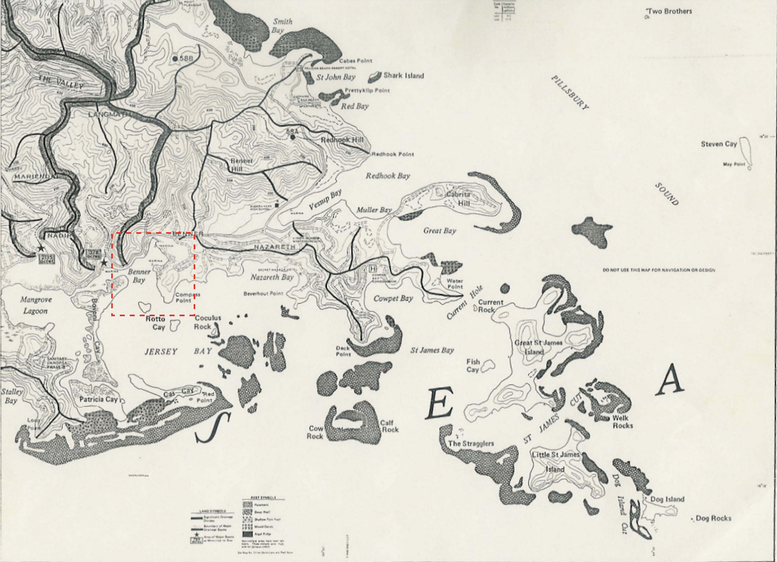
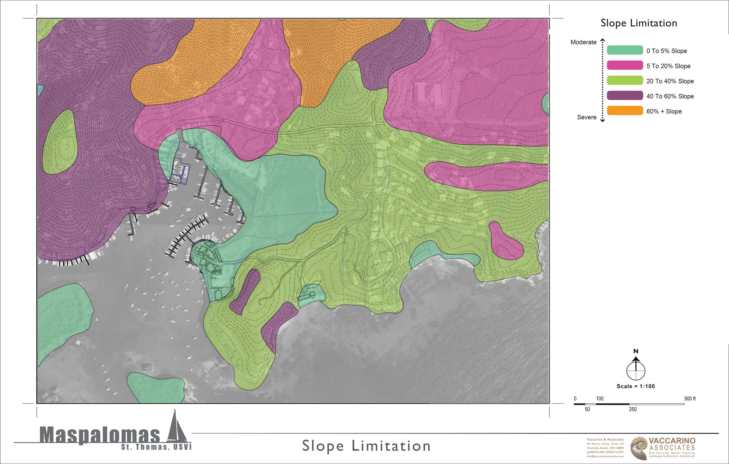
This project entailed the site analysis and planning studies for the expansion of an existing marina with associated services and an 18-acre mixed-use neighborhood that would include residential, offices, commercial space, a restaurant, yacht club, and other amenities. The existing marina and undeveloped land were in the sensitive area of Jersey Bay, surrounded by mangrove habitats and marine life. The clients intended to buy all nearby mangrove/wetland land and preserve it in exchange for the permit for a new road to better access the marina.
Among the planning challenges were the road setback compliances from the salt pond and the need to engineer biofiltration areas for the new road runoff discharge. The proposed marina expansion did not require removal of mangroves, nor fueling facilities or underground petroleum storage, but a portion of the desired mixed-use development and associated parking needs would not be suitable for steep slopes, and the project was not pursued.




THREE SITES, CULEBRA PUERTO RICO
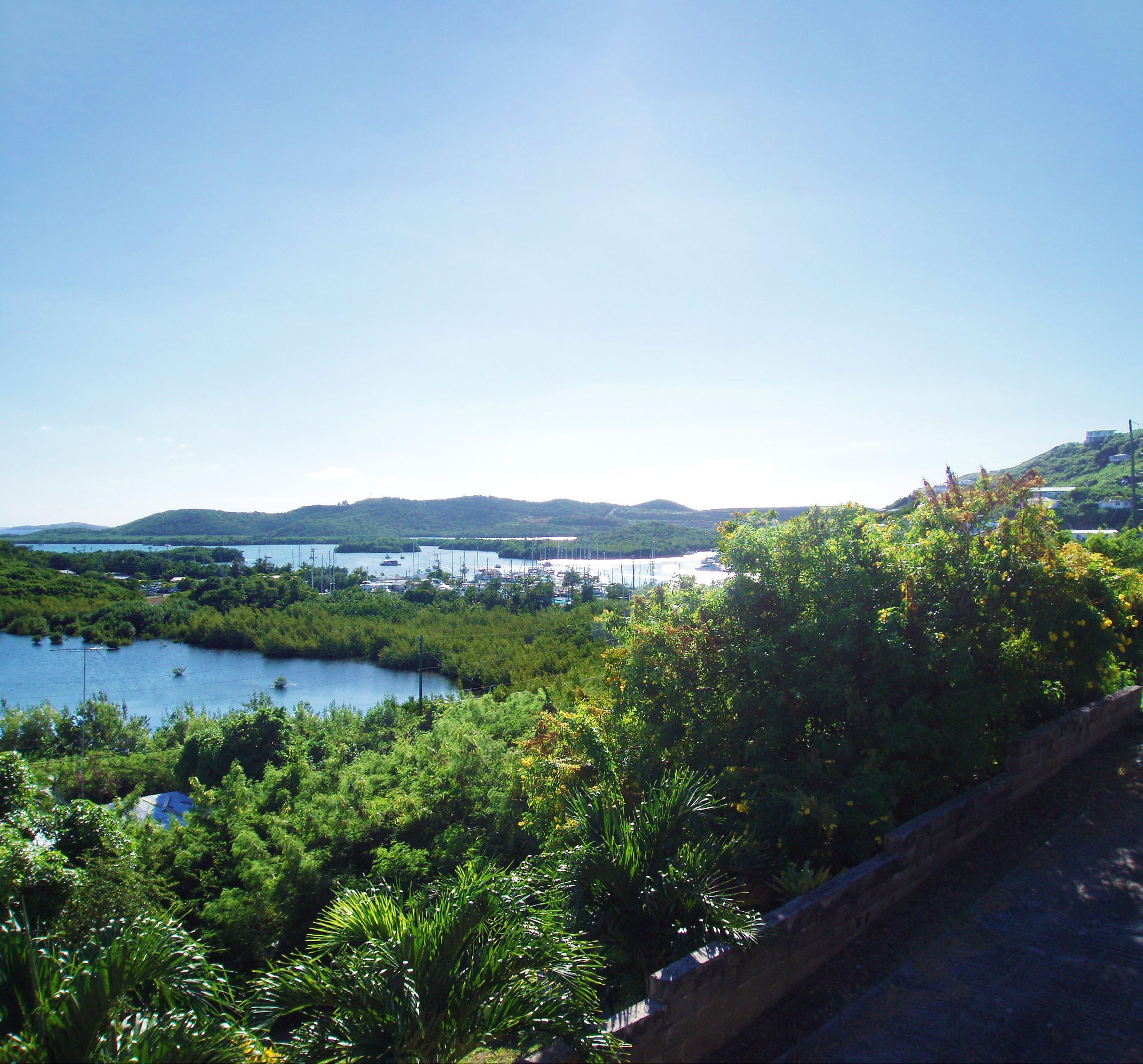
We were the planners and landscape architects in the design team hired to prepare preliminary programming and feasibility studies for the development of a property totaling about 300 acres and divided into three different sites on Culebra Island, each highly sensitive and beautiful for its topography and natural features. We offered a mapping and planning process that is based on site-sensitive planning and design, where the existing vegetation, soils, hydrology, and slope/aspects determine the development patterns and density. From our analysis, two of the sites appeared to be too sensitive in slope for the density of development desired. The project was halted in its early inception.
The program included: 1. a recreational facility, with a pavilion-style farm-to-table restaurant, beach cabanas, and possibly eco-tents (illustrative concept depicted below); a Tennis Academy in the second site, with services and housing included for students, teachers and staff; 3. a Culinary Art Trade School in the third site, with associated organic farm and an enterprise/cooperative entity to grow a good amount of local produce.


